Did you know that there are currently several scientific research projects taking place on Placer Land Trust preserves? This is part of a series of articles about the important research taking place on our protected lands.
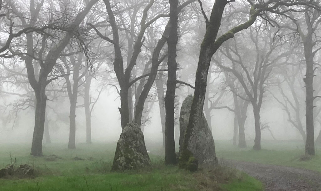
Mist-erious rocks at Taylor Ranch Preserve
By Sarah Roeske
Placer Land Trust Docent and Research Scientist at University of California Davis, Earth and Planetary Sciences Department
If you have hiked at Big Hill or Harvego, you know there are rocks at the surface – lots of them! Bob Niblack, Karl Mertz, and myself have lead Geology-Hydrology tours of Big Hill for over 10 years, but it wasn’t until 2022 that I started to do research in this area with undergraduates from UC Davis. My research interests focus on faults, including how to recognize major ones in the rock record.
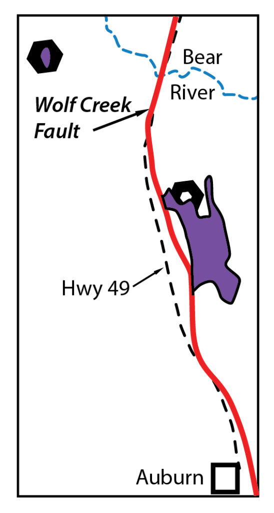
A significant fault, the Wolf Creek fault, runs along Hwy 49, and geologists debate when most of the movement, or slip, on it occurred. No recent movement has been detected but the geologic history of rocks in the fault zone suggest it may have been a plate boundary (i.e. very major fault) ~200 million years ago. One way to address the fault’s movement history is to look at the rocks on either side of it and compare their histories; when their histories are similar then we determine that most of the movement happened prior to that time. The challenge in the foothills is that many of the rocks are covered in soil, or they are exposed on private property and access isn’t guaranteed. Fortunately for us, some of the key locales for analyzing the history of the Wolf Creek fault are on Placer Land Trust’s lands or in conservation easements that they hold. Not only do these properties have locally well-exposed rocks we found willing landowners on both sides of the fault!
Our first project was inspired by a 1970s era geologic map that included the Harvego- Bear River Preserve and Big Hill areas. The map showed that almost all the bedrock exposed is volcanic rock or sediment derived from volcanic rock, part of a unit known as the Smartville complex. However, the geologic map showed a small patch of serpentinite, which forms much deeper in the crust than volcanic rock, on the Harvego Preserve. Undergraduate Julianna Velazquez determined the contact between the Smartville volcanic sediment and the “basement” (serpentinite of unknown age) is depositional, which had not been confirmed before. She extracted the mineral zircon, which contains very low levels of Uranium, from the Smartville and by using a mass spectrometer to separate the isotopes of uranium and other elements, determined the Smartville complex in this area is ~160 million years old. The age is the same as large granite bodies (plutons) east of the Wolf Creek fault, particularly the Yuba Rivers pluton, suggesting that the rocks on either side of the fault may have been close to one another at that time.
To further test this idea, we wanted to examine the rocks exposed just east of the Wolf Creek fault, and fortunately some very interesting ones are not far east of Harvego Preserve, on the Oest Ranch, which Daryl Oest has put in a conservation easement with PLT. I asked Daryl if we could take a look and he said sure, check out the rocks, there’s a chromite mine up on the hill – that got my attention! Chromite is almost always associated with serpentinite, so we checked it out and sure enough, not only is there serpentinite (basement) well-exposed, but also lots of volcanic rocks with interlayered sediment! Previous maps in the area did not show any volcanic rocks at all on this property or in the greater area around it, so this was a surprise.
Cole Hayes, currently a senior in the Earth and Planetary Sciences Department at UC Davis, is mapping the area, documenting the relations of the different rock types to each other, and he recently acquired zircon dates from several of the volcanic and sedimentary rocks. More surprises! He not only found the same ages in the volcanic-derived sediment on the Oest Ranch as Julianna found west of the Wolf Creek fault, on the Harvego Preserve, but also found a much older volcanic rock that erupted around 207 million years ago. Researchers thought there might be volcanic rocks in this age range north of the Bear River, but no one has had success dating these rocks before this study.
These two short studies are perfect for undergraduate researchers because they can visit their project area multiple times, make original observations and collect important data. They have made significant contributions to our understanding of the timing of geologic events in the foothills and how it relates to the tectonic history of the northern Sierra Nevada. Without the Placer Land Trust’s acquisition of land and Daryl Oest’s conservation easement and willingness to give us access it would have been very difficult or impossible to get on these properties multiple times to do scientific research.