
 Waterfall at Southern Cross Preserve
 North Fork of the American River at Southern Cross Preserve
 Southern Cross Mine, main adit entrance
 North Fork of the American River at Southern Cross Preserve
 Euchre Bar Trail
 North Fork of the American River at Southern Cross Preserve
Quick Facts:
- 46 acres of canyon land along the North Fork American River
- Land protected in 2019
- Wooded river canyon terrain, with several hundred feet of Wild & Scenic river frontage
- Prime wildlife habitat; includes a section of the public Euchre Bar Trail
- Euchre Bar trail remains fully open, with no changes to public access
- Transferred to US Forest Service ownership in 2020
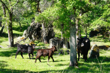
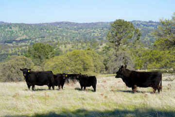
The Southern Cross Preserve is located on the south side of the North Fork American River. The property consists of mature forest, and incorporates several hundred feet of river frontage. Bird and mammal species include mountain quail, mourning doves, Steller’s jays, western bluebirds, warblers, squirrels, skunks, chipmunks, coyotes, mule deer, black bears and mountain lions.
The public Euchre Bar Trail runs through the property and provides excellent views of the river. Recreation activities possible from the Euchre Bar Trail include trout fishing, swimming, and floating the river.
The property was transferred to USFS ownership in 2020, and is now a permanently protected part of the Tahoe National Forest. Read more about the transfer project here.
Conservation Values
The Southern Cross Preserve is nestled within the Tahoe National Forest. The property is located directly across the river from the PLT-assisted Siller Preserve 2 (now under USFS ownership), and is about 3.5 miles upstream of PLT’s Bailey NF Preserve and Siller Preserve 1. Placer Land Trust strives to protect land that is adjacent to other protected land to create larger areas of intact wilderness to provide critical habitat, safeguard water and air quality in the region, and support healthy, diverse populations of plants and wildlife. Placer Land Trust is also working with the U.S. Forest Service to explore the feasibility of transferring ownership of the property to USFS/Tahoe National Forest.
The wooded canyon land Preserve includes several hundred feet of federally-designated Wild & Scenic river frontage, which affords protection of land within ¼ mile of the river, and is a state-designed “Wild Trout Water.”
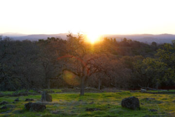
The property is made up of high-quality riparian and mid-elevation forest typical of the river canyon. With a northern-facing slope, the forest is predominately mixed conifer with some black oak and montane hardwood at the southern/upper end. It appears to be a fairly mature forest with a healthy shrub and herbaceous layer.
Southern Cross Preserve is surrounded by federal USFS land to the north, west, and east. Protection of the property connects federal land along the river corridor and removes a private inholding.
History
The Southern Cross Preserve property includes the Southern Cross Gold Mine, a historic mine that was operated from the early 1900’s likely through the 1940’s. The mine includes four adits (openings), with the main one located off Euchre Bar Trail. The main adit hosts a relatively intact tunnel with many spurs and cart tracks. Nearby on USFS land is a 5-acre millsite with many historic millsite artifacts. An environmental site assessment at the mine and millsite concluded there was no contamination from heavy metals, or environmental issues of concern. However, safety issues are a concern due to instability and lack of ventilation, and entry to the mine is prohibited.
Funding for the purchase of the property came from PLT’s 2017 Placer Conservator Fund-A-Need auction and the Emigrant Trails Greenway Trust.
Recreation Values
The public Euchre Bar Trail runs through the property and provides excellent views of the river. This is an exceptionally scenic, wild and remote section of the river canyon. Recreation activities possible from the Euchre Bar Trail include trout fishing, swimming, and floating the river. Protection of the property will also help protect the historic Southern Cross gold mine.
Visit the Preserve
The Euchre Bar Trail is a public trail that is open to public hiking, including the portion through the Southern Cross property. To hike the Euchre Bar Trail: park at the public “Euchre Bar Alta Trailhead” off Casa Loma Road, I-80 Alta Exit (146). Hike down to the river, cross the river via the footbridge, and head up river as far as you want. Return to the trailhead via the same trail route (out and back). The Euchre Bar trail ends at Humbug Creek, where it hits private land and a private dirt road. Please do not trespass onto the private dirt road. For your safety, please stay on the trail and do not enter any mine tunnels.
0 Comments